Creating one trusted source for complex water information
Bureau of Meteorology
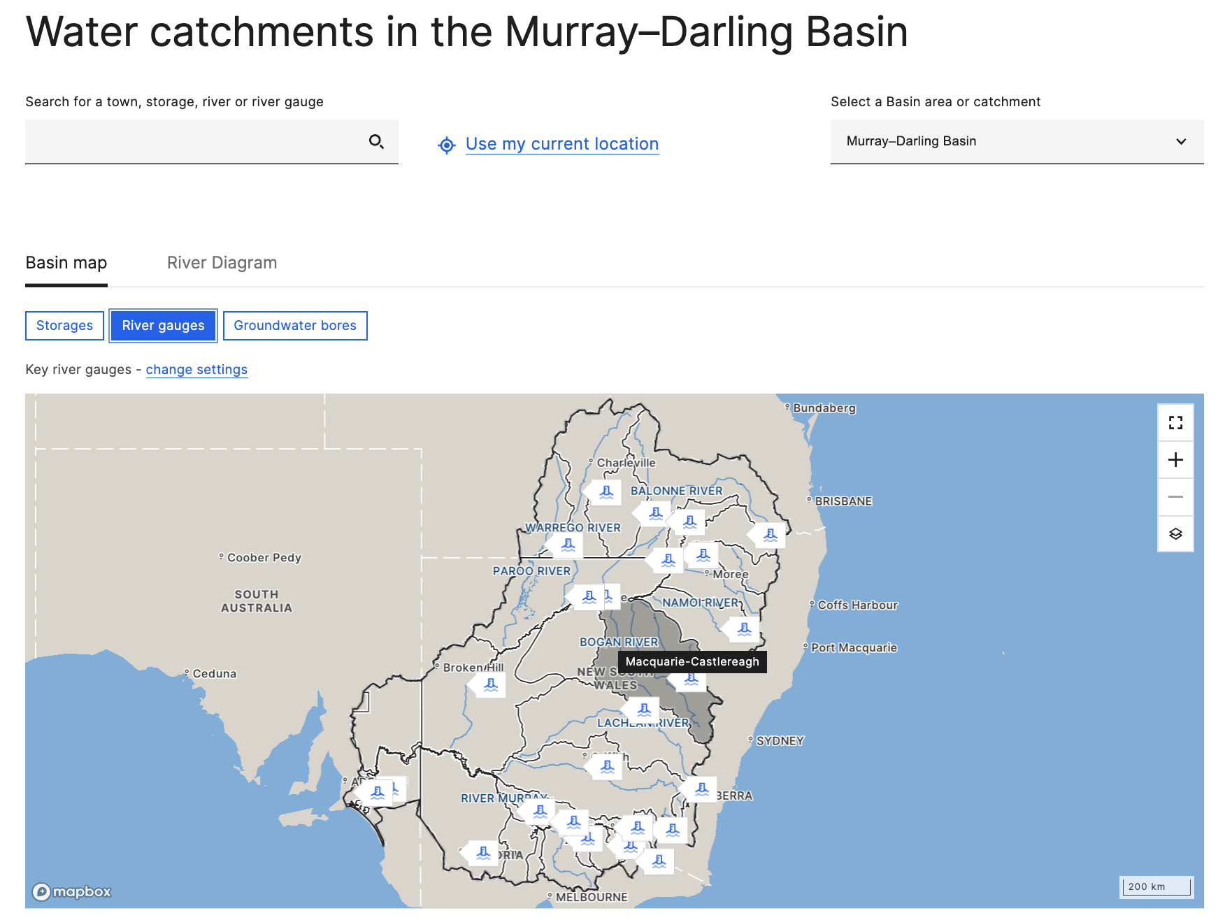
The Murray–Darling Basin Water Information Portal was created to provide communities and water users with one place to access clear and current information about water across the Basin.
The portal brings together information about water availability, storages, allocations, pricing and trading in a publicly accessible service.
I worked across discovery, stakeholder engagement, prototype validation, design iteration and the creation of high-fidelity concepts for development.
The portal was also the first major Bureau product launched using the new website interface styles, well before the wider Bureau website was released.
At a glance
Organisation
Bureau of Meteorology
Bureau of Meteorology
Project focus
Water information, public services and complex data
Water information, public services and complex data
Project period
August 2020 to June 2021
August 2020 to June 2021
My contribution
•Discovery and stakeholder engagement
•Prototype testing and iteration
•Information and experience design
•High-fidelity concepts
•Development handover
•Discovery and stakeholder engagement
•Prototype testing and iteration
•Information and experience design
•High-fidelity concepts
•Development handover
Outcome
Minimum viable product launched in June 2021
The challenge
Water information across the Murray–Darling Basin was spread across multiple organisations, websites and data sources.
People needed to find and interpret information about:
•water availability
•storages and reserves
•allocations
•water markets and pricing
•trading
•conditions across the northern and southern Basin
In September 2019, the Australian Government committed to developing an online source that would support implementation of the Murray–Darling Basin Plan.
The proposed service needed to provide near real-time information, updated in practice approximately every 24 hours, without requiring users to create an account or log in.
The central design question was:
How might we create an online water information source that gives communities and water users clear, direct and current information so they can better monitor and manage water?
Why the service was complex
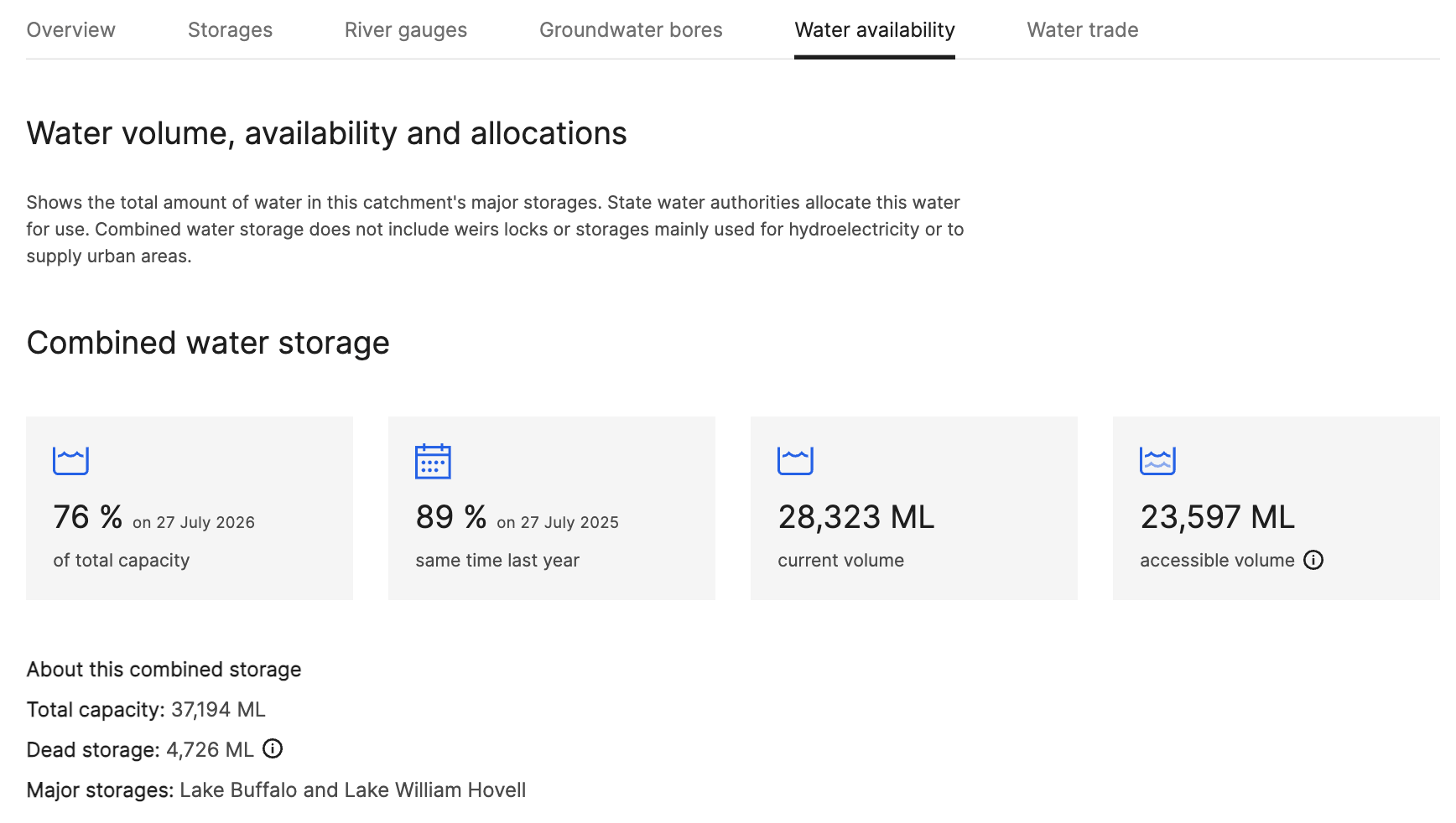
The Murray–Darling Basin is a large and interconnected system spanning multiple jurisdictions, communities, industries and environmental interests.
The project needed to connect with several related initiatives, including:
•the Northern Basin Water Information Portal
•an interim directory of existing water resources
•water-market research and reform work
•data held by different authorities and jurisdictions
The portal needed to serve people with different levels of knowledge and different reasons for using water information.
Some users needed a broad understanding of Basin conditions.
Others required detailed information to support water use, planning, trading or operational decisions.This meant the experience needed to make complex information accessible without oversimplifying it.
Using prototypes to discover and validate
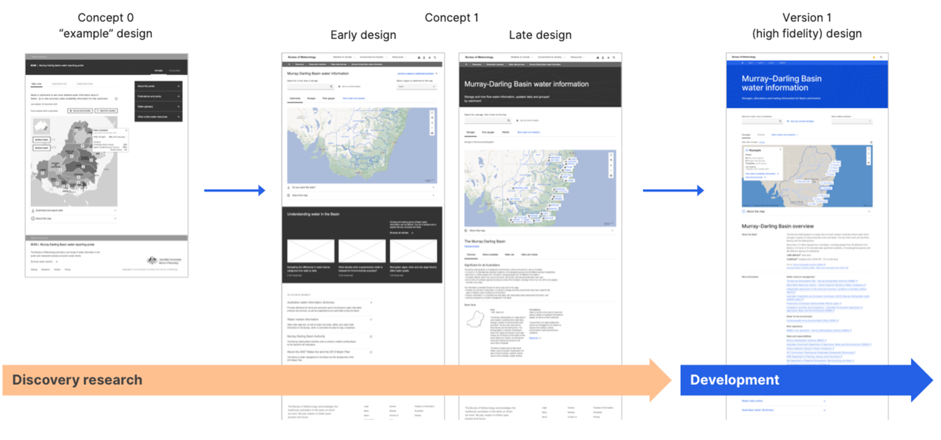
The project began with an early prototype based on what was already known about the service and its likely information requirements.
Rather than treating those assumptions as fixed requirements, prototypes were used as a research tool allowing stakeholders and users to respond to something tangible and helped the team understand:
•which information people valued
•what terminology required clarification
•how people expected the information to be organised
•what was missing
•how much detail different users needed
•where data and design dependencies existed
The project involved a wide range of stakeholders connected to water information, policy, management and use across the Basin.
Engagement was used to discover and define the information needs and expected experience of the portal through user testing and iterating on findings.
Making complex data understandable
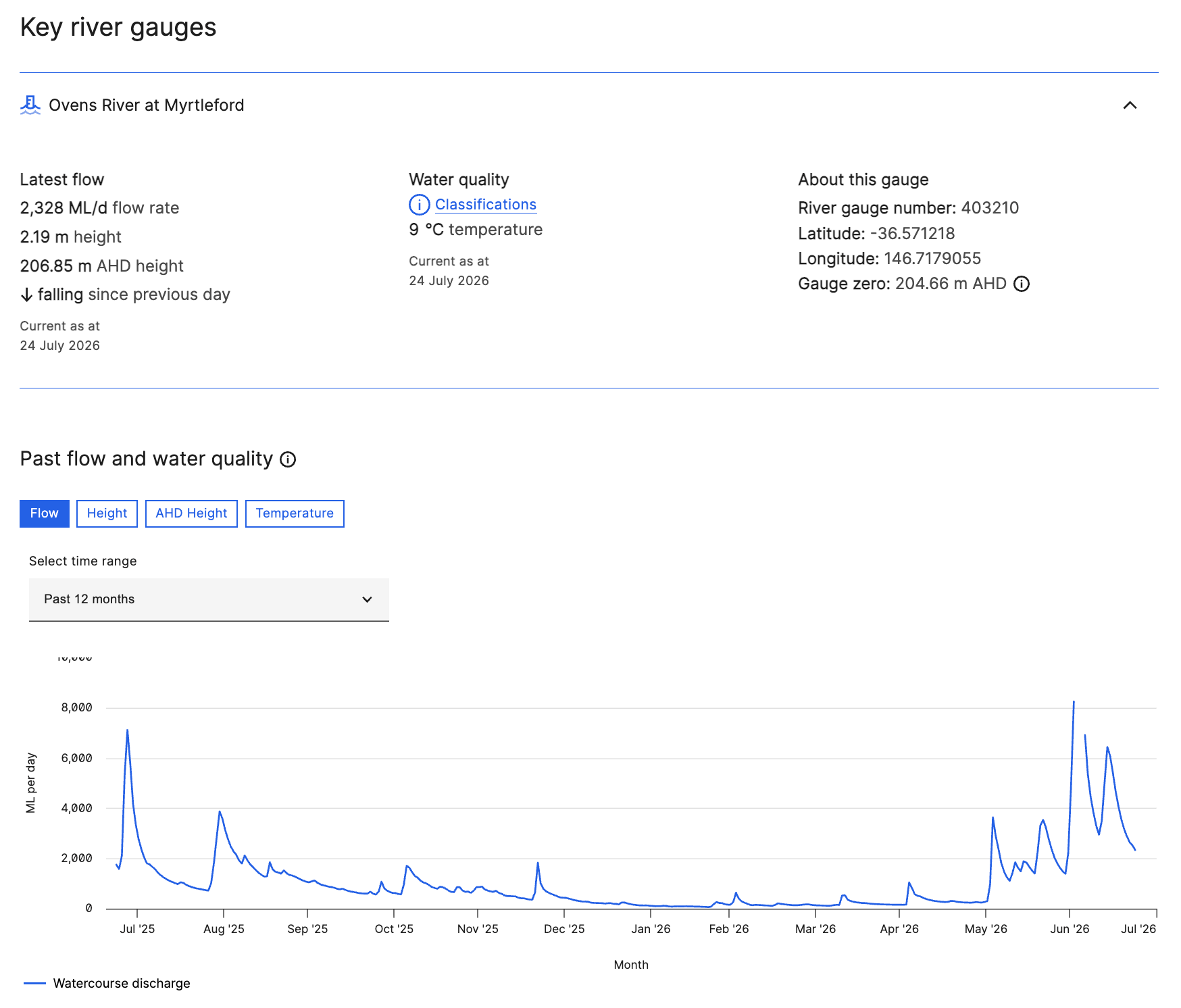
The portal needed to bring together information that was technical, spatial and frequently changing.
The design needed to help people:
•gain a quick understanding of current Basin conditions
•move between broad and detailed views
•understand how different information was related
•locate trusted data without visiting multiple services
•interpret information with different levels of water knowledge
This required close attention to information hierarchy, terminology, navigation, data presentation and visual consistency.
The aim was not simply to place more data online. It was to create a service through which people could make sense of the data.
Introducing the new Bureau interface styles
The portal was the first major public product to use the new Bureau website interface styles.
At the time, the wider Bureau website had not yet launched with the new design direction.
This created an opportunity to demonstrate how the emerging styles could work within a complex, data-rich service rather than only on standard content pages.
The project helped test how the new visual language, components and interaction patterns could support:
•detailed environmental information
•maps and data
•responsive layouts
•public accessibility
•consistent navigation
•trust in a government information service
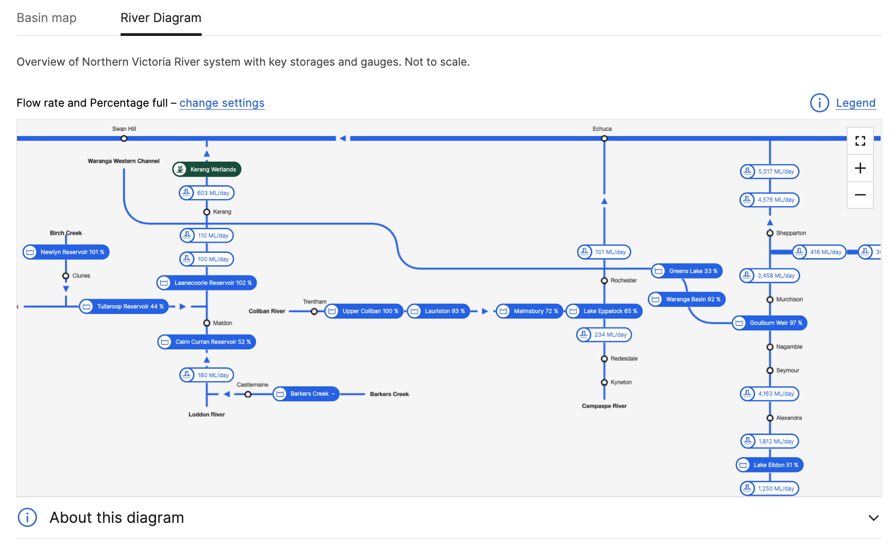
From research to launch
The project deliverables included:
•a report on customer engagement
•validation of the prototype
•refined concepts
•customer satisfaction measures
•high-fidelity visual designs
•a prioritised data-integration and feature backlog
•design material prepared for development
The minimum viable product launched in June 2021.
The live service created a foundation for bringing northern and southern Basin information into one public experience.
The project delivered:
•one public entry point for Murray–Darling Basin water information
•access without an account or login
•a validated design informed by stakeholders and end users
•a clearer way to explore supply, reserves, allocation and water-market information
•a high-fidelity experience ready for development
•the first major use of the Bureau’s new website interface styles
•an MVP launched in June 2021
•a foundation for further data integration and feature development
The portal remains a strong example of designing a public service around complex environmental information.
My contribution
I worked across the project from early discovery through to the design prepared for development.
My contribution included:
•translating the service proposition into testable concepts
•preparing and refining prototypes
•supporting stakeholder showcases
•conducting and synthesising end-user research
•identifying customer information needs
•iterating the information structure and experience
•validating the concept direction
•developing high-fidelity visual concepts
•supporting the transition into development
•contributing to data and feature prioritisation
The work required me to connect user needs with complex water information, related government initiatives and practical data-integration constraints.
What I learned
This project reinforced that complex information services cannot be designed through interface work alone.
The usefulness of the experience depended on understanding the information ecosystem, the relationships between related initiatives and the practical effort required to integrate data.
Using an early prototype as a research tool was particularly valuable. It allowed stakeholders and users to respond to a concrete proposal while the direction was still open to change.
The project also showed the importance of progressive disclosure. Different users required different levels of detail, and the design needed to support both quick understanding and deeper exploration.Launching the first product with the new Bureau website styles demonstrated how a developing design system could be applied to a complex service and helped establish confidence in the wider design direction.
Related Bureau work
Explore my broader work at the Bureau of Meteorology, including Public Weather Discovery, Public Safety and the BOM Weather app.